With geo-tagging enabled, tweets include information on the location of the user when the tweet was sent. Miguel Rios (@miguelrios) has plotted locations of billions of tweets to create maps of the world. This is pretty amazing stuff – a world map rendered just from twitter posts!
Maps are created using every tweet from 2009 using R and the ggmap package.
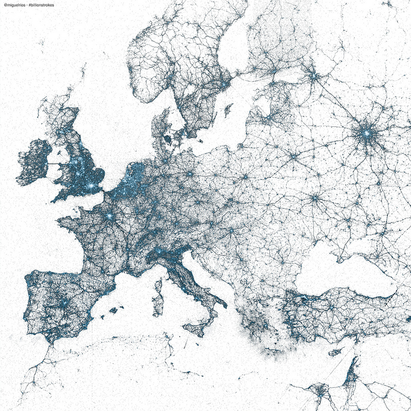
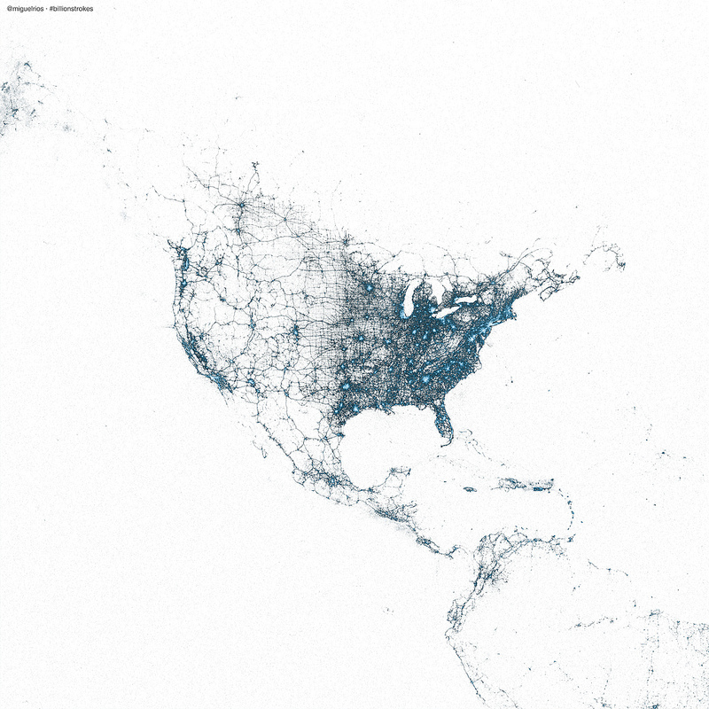
Post is here with more here on flickr.